December 4, 2017 - San Francisco From the Air
On a flight in the aluminum tube to San Francisco for work, I looked out window and there was the Golden Gate bridge and the city. Visibility was excellent, so I pulled out the smart phone and started taking pictures. Later on, I was amazed at how well they came out.
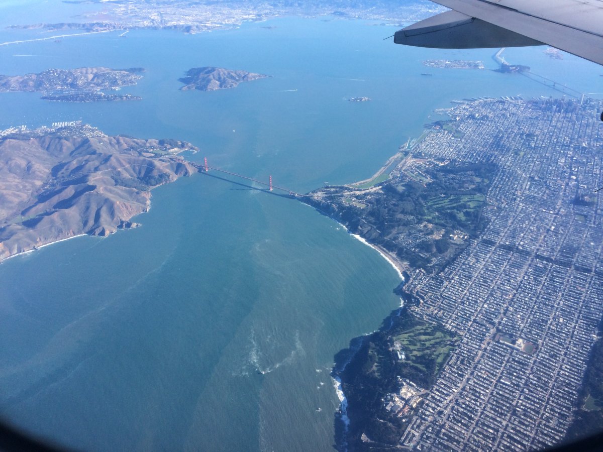
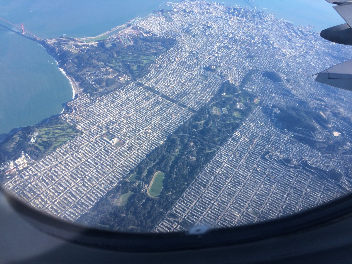
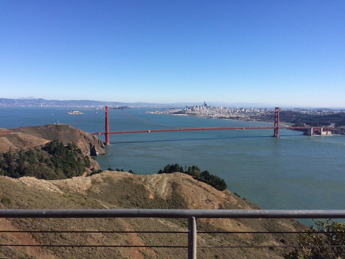
That's the Golden Gate Bridge in the center with the city of San Francisco on the right. The wooded area to the right of the Golden Gate is what used to be the Presidio Army base. The wooded area at lower right is the Lands End area.
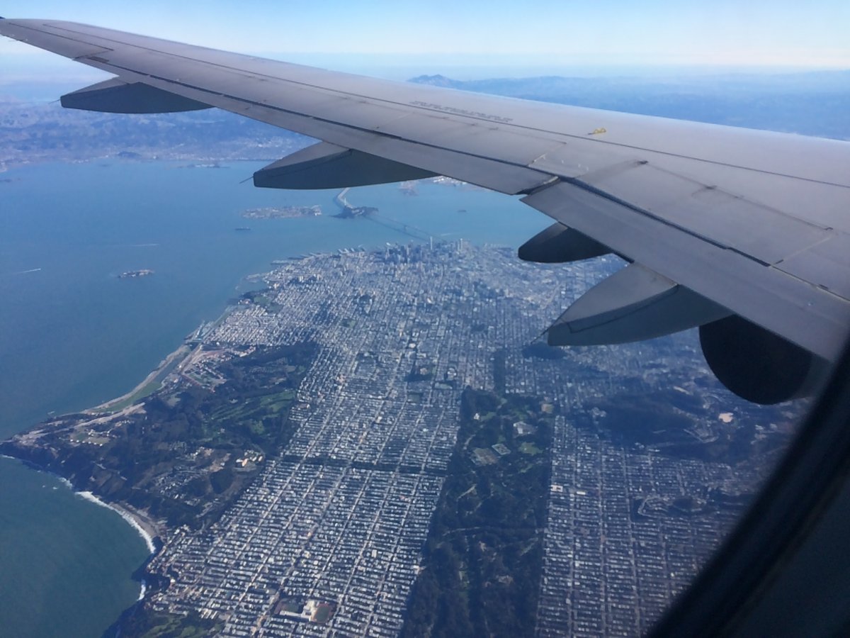
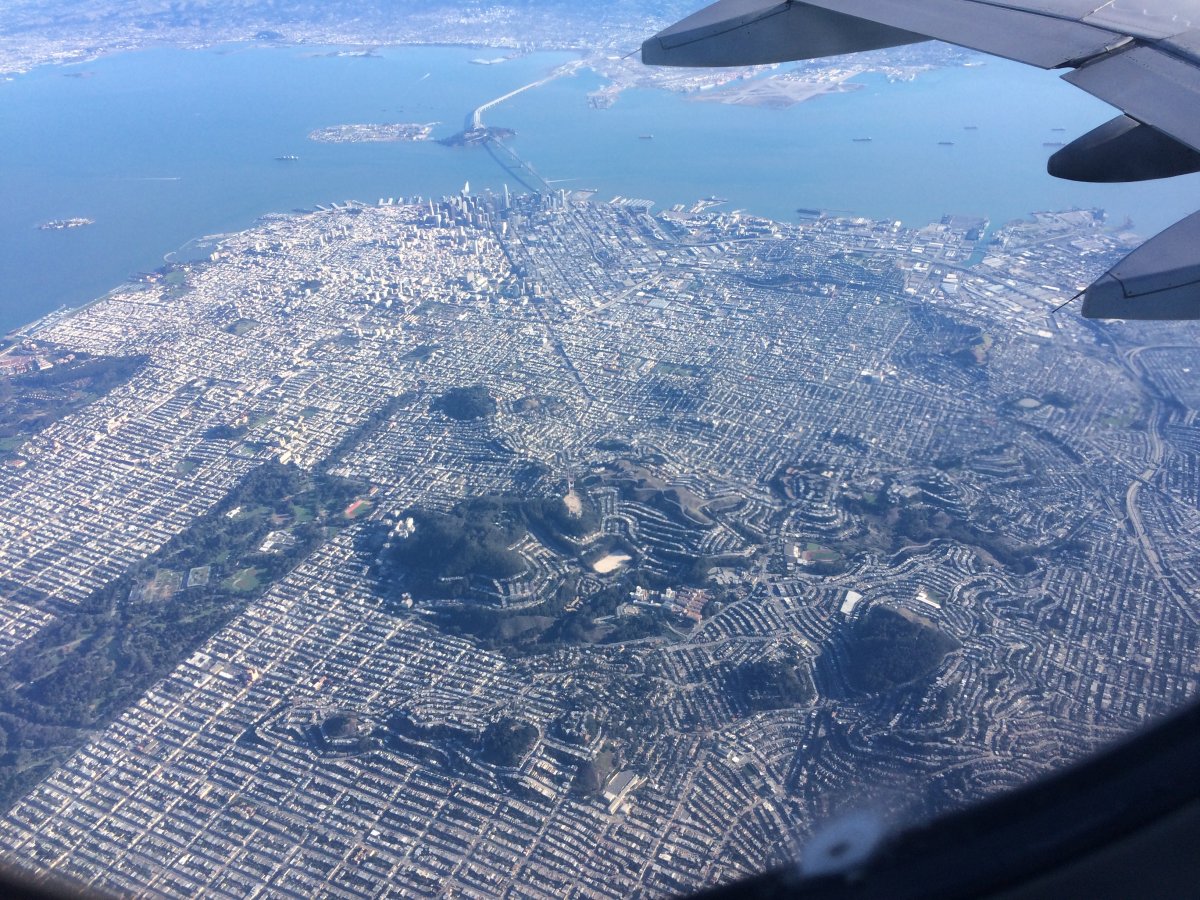
We continued south and the Golden Gate Park came into view, center of the picture. The Bay Bridge is also visible just under the wing.
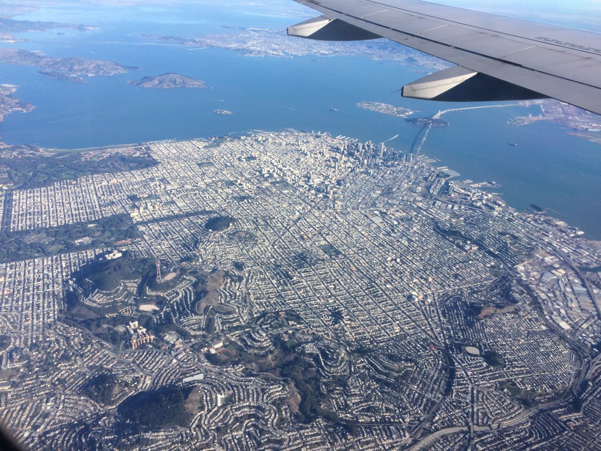
A spectacular view of the entire city, with the Bay Bridge at top.
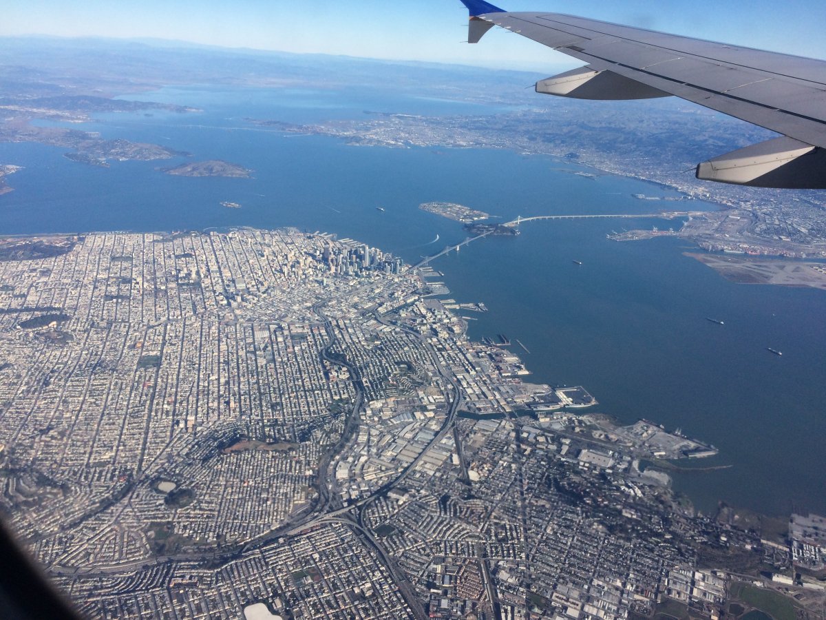
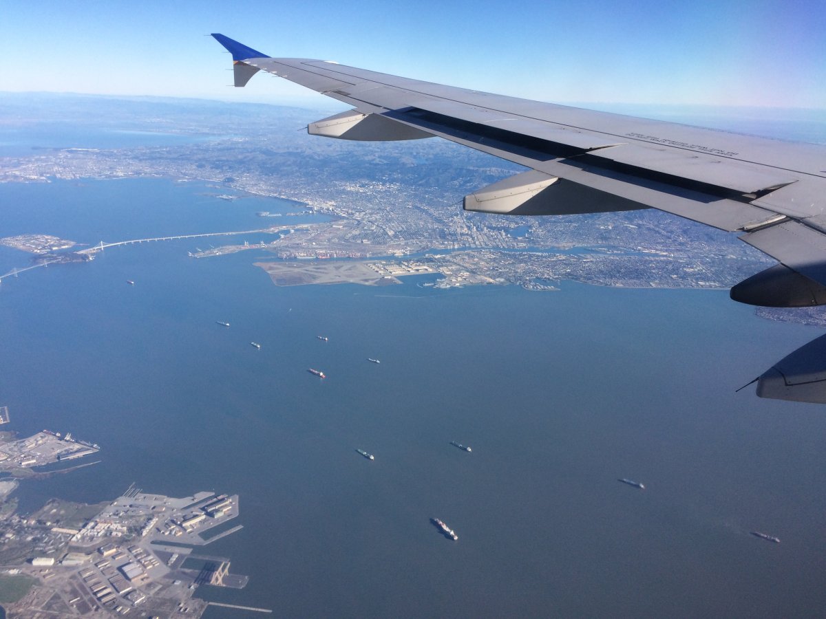
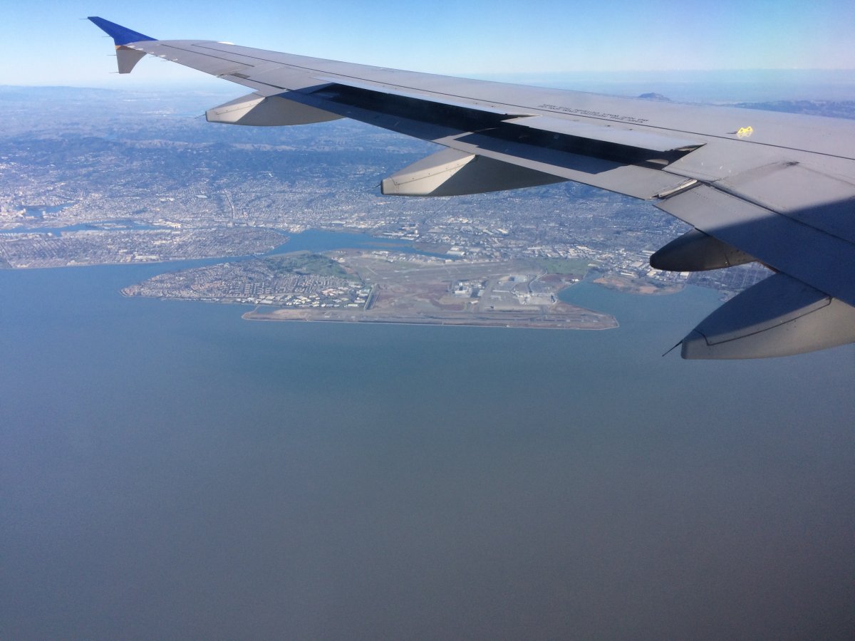
Old Alameda Naval Air Station -- long since closed -- is visible in the center under the wing. The World War II aircraft carrier USS Hornet is near there and open to the public.
Passing Oakland International Airport. We flew practically to Palo Alto before making a 180 degree turn and coming into land at San Francisco International.
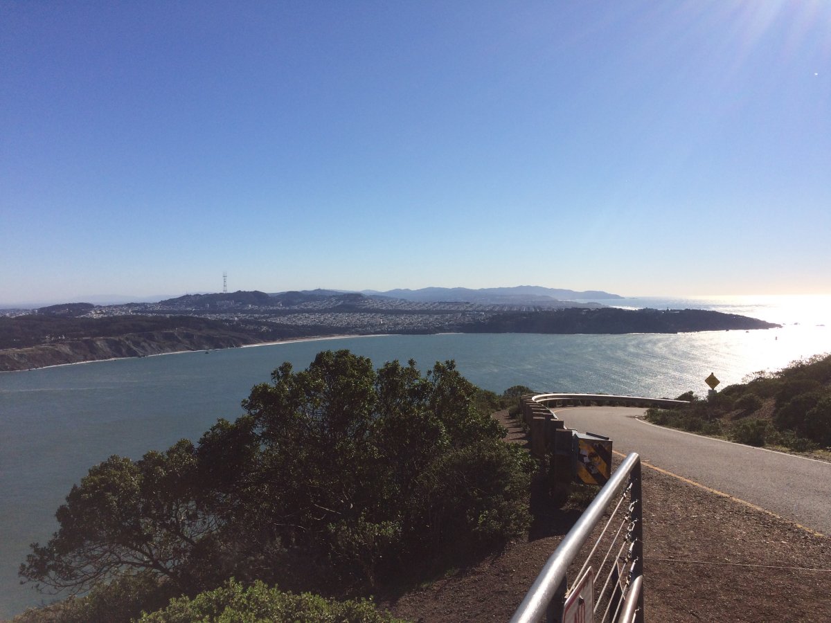
Pointint the camera south to capture Lands End on the right.